File:The Settlement Historic District -- Texas City.jpg
Original file (5,281 × 3,648 pixels, file size: 8.77 MB, MIME type: image/jpeg)
| This free media file is from Wikimedia Commons. Its description page is included below. |
Summary
| Description |
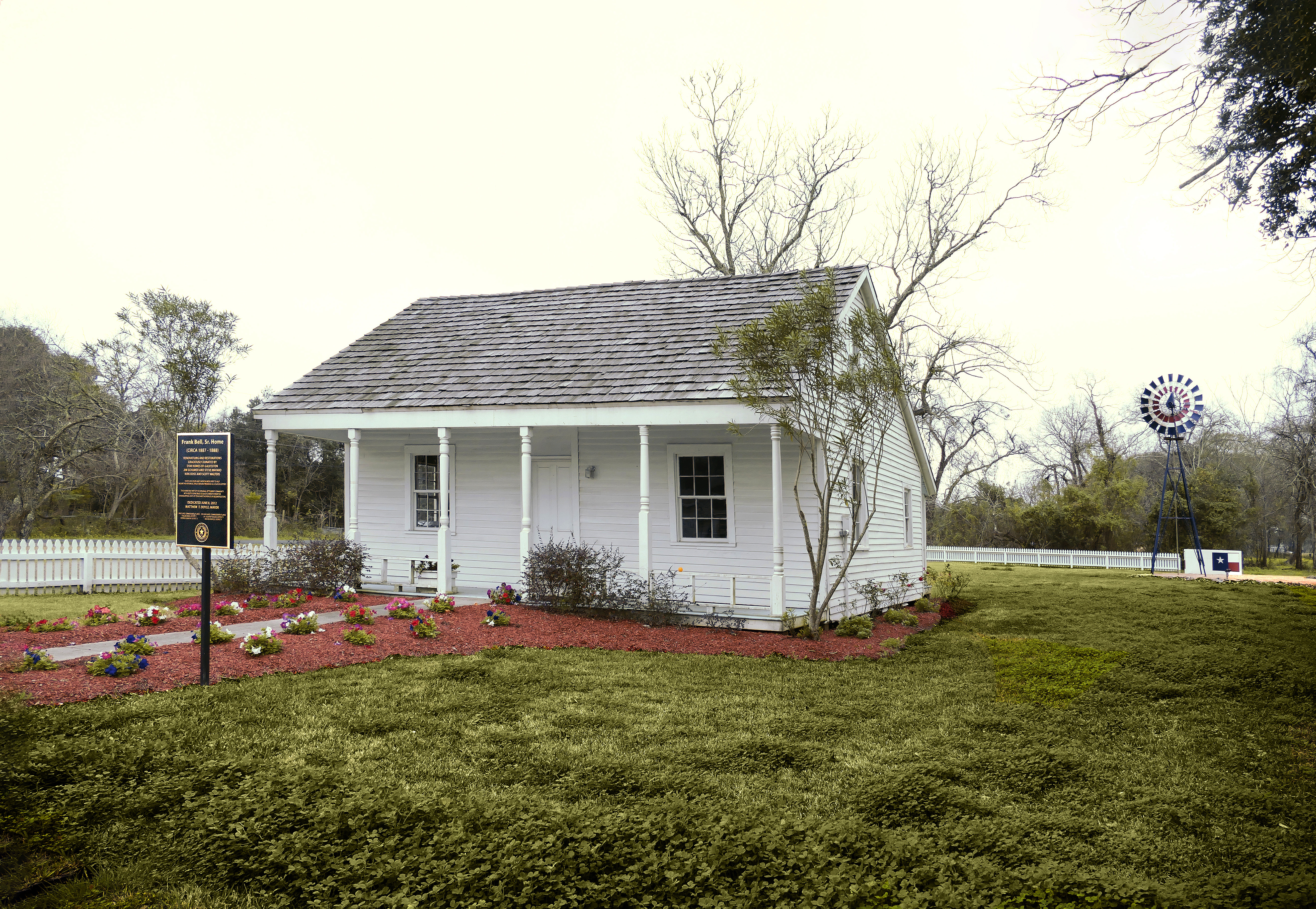
English: During Reconstruction former slaves founded a community known as the Settlement on land platted by Judge William J. Jones for purchase by freedmen. Prior to this, a number of cattlemen moved to this area with their slaves. During the Civil War, George Washington Butler was placed in charge of a containment camp and used slave labor from there to drive cattle for the Confederate Army. After the war ended, Butler continued in the cattle industry, hiring freedmen as Cowboys. Some of them lived in the community first known as Highland Tank.
The first settlers were Kneeland and Slyvia Britton,and Albert and Priscilla (Britton) Phillips. Calvin Bell, Thomas Britton and David Hobgood were area Cowboys and pioneers of the community. By 1870 the Rev. Israel S. Campbell helped begin a church; residents built a sanctuary and school the following year in a community called Campbellville for the Reverend. Pioneering families, however called it Settlement shortened from “Our Settlement,” declaring the importance of freedom and owning land. The African American community prospered throughout the late 1800s. Many male residents worked on Butler Ranch or as farmers. Also, unique for the time, the community had a high literacy rate. By the early 1900s residents worked in railroad occupations and later in industry. In 1911, an interurban line came through the community, and Highland Station opened; the Settlement was known as Highlands and La Marque until it was incorporated into the city limits of Texas City in the 1950s. The community began to decline in the 1960s, when many young people left to work in an integrated society. However, rodeos and trail rides have been held as reminders of this once flourishing and self-sufficient community founded by African American Cowboys. |
| Date | |
| Source | Own work |
| Author | Jim Evans |
| Camera location | | View this and other nearby images on: OpenStreetMap |
|---|
|
This is an image of a place or building that is listed on the National Register of Historic Places in the United States of America. Its reference number is 10000268. |
Licensing
- You are free:
- to share – to copy, distribute and transmit the work
- to remix – to adapt the work
- Under the following conditions:
- attribution – You must give appropriate credit, provide a link to the license, and indicate if changes were made. You may do so in any reasonable manner, but not in any way that suggests the licensor endorses you or your use.
- share alike – If you remix, transform, or build upon the material, you must distribute your contributions under the same or compatible license as the original.
File history
Click on a date/time to view the file as it appeared at that time.
| Date/Time | Thumbnail | Dimensions | User | Comment | |
|---|---|---|---|---|---|
| current | 00:13, 20 October 2020 | | 5,281 × 3,648 (8.77 MB) | Jim Evans | improved perspective, darkened forground |
| 18:05, 12 February 2020 |  | 5,472 × 3,648 (8.65 MB) | Jim Evans | better angle | |
| 03:27, 18 January 2020 |  | 5,300 × 3,447 (6.89 MB) | Jim Evans | User created page with UploadWizard |
File usage
The following 2 pages use this file:
Global file usage
The following other wikis use this file:
- Usage on af.wikipedia.org
- Usage on de.wikipedia.org
- Usage on en.wikipedia.org
- Usage on www.wikidata.org